
Download myPhotoMap – free Mac geography photo mapping tool
Overview of myPhotoMap
myPhotoMap is a dedicated macOS application created by Dirk Stichling that turns your personal photo collection into an interactive geographical map. Positioned in the Education & Reference category with a sub‑category of Geography, the tool lets users attach location data to images, view them on a world map, and explore travel memories in a visually compelling way. First added to our catalog in 2016, the software has already amassed over 1 million downloads, reflecting a steady interest among educators, travel enthusiasts, and casual photographers alike.
The current version (2.3.4) was released on 1 April 2017 and remains compatible with macOS X and earlier releases. Available in both English and German, myPhotoMap offers a bilingual interface that broadens its appeal across European markets. While the exact install size is not disclosed, the lightweight nature of the program means it can be installed on older Mac machines without compromising performance.
The application is free to download, and its secure update mechanism ensures users always have the latest features and bug fixes without manual intervention. Whether you are a teacher designing a geography lesson, a blogger chronicling a world tour, or a family member wanting to relive vacation moments, myPhotoMap provides a straightforward, secure, and engaging way to turn photos into a map‑based storytelling experience.
Key Features and Benefits
- Interactive World Map Integration – Drag and drop photos onto a global map, instantly visualising where each picture was taken.
- Automatic Geotagging Support – The app reads embedded GPS data from JPEG and PNG files, placing images on the map without manual entry.
- Manual Location Assignment – For photos lacking GPS metadata, users can assign locations using a simple search‑and‑pin interface.
- Multi‑Language Interface – English and German menus make the tool accessible to a broader audience.
- Exportable Map Projects – Save your mapped collection as an interactive HTML file or PDF, perfect for presentations or sharing online.
- Customisable Markers – Choose from a variety of pin styles, colours, and labels to differentiate trips, events, or themes.
- Zoom‑able Detail View – Zoom into any region to see thumbnail previews, allowing quick identification of specific images.
- Secure Automatic Updates – The built‑in updater checks for new releases and installs them safely, keeping the software current.
Pros
- Intuitive drag‑and‑drop workflow reduces learning curve.
- Free download with no hidden subscription fees.
- Fully native macOS experience; no need for additional runtimes.
- Supports both automatic and manual geotagging, covering all photo sources.
- Export options cater to educators, bloggers, and casual users alike.
Cons
- Only available for macOS; Windows and mobile users cannot run the app.
- Install size not published, which may concern users with limited disk space.
- Last major update was in 2017; some modern macOS features are not leveraged.
- No built‑in cloud sync; users must manage backups manually.
- Limited advanced editing tools (e.g., photo filters) compared to full‑featured photo managers.
Installation, Usage, and System Compatibility
Step‑by‑Step Installation
- Visit the official myPhotoMap download page and click the “Download for macOS” button. The file is a standard
.dmgpackage. - Once the download completes, double‑click the
.dmgto open the installer window. - Drag the myPhotoMap icon into the Applications folder shortcut provided.
- Eject the mounted disk image and launch the app from the Applications folder or Spotlight.
- The first launch will prompt you to allow access to your Photos library; grant permission for seamless import.
Getting Started Quickly
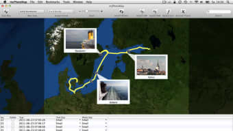
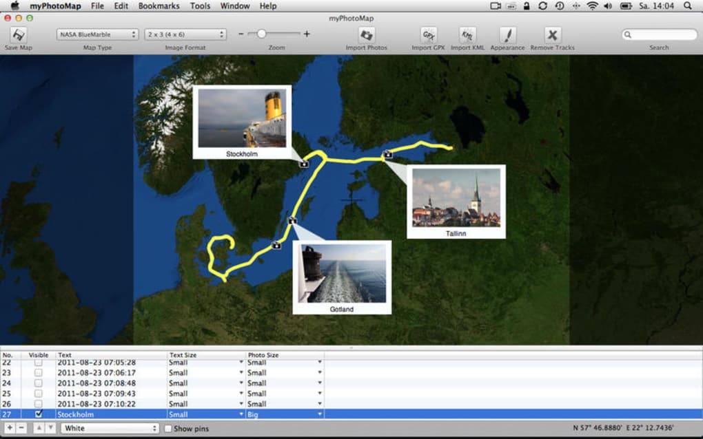
- Upon opening, you’ll see a blank world map with a toolbar at the top.
- Click the “Import Photos” button to select images from a folder or directly from the Photos app.
- If the images contain GPS data, they will appear on the map automatically. Otherwise, the app will ask you to place each photo manually.
- Use the search bar to locate a city or country, then drag a pin to the exact spot where the photo was taken.
- Customize each pin by right‑clicking it, selecting “Edit Marker,” and choosing a colour or label.
- When you’re satisfied, choose “Export Project” to generate an interactive HTML file or a printable PDF.
System Compatibility
myPhotoMap is built exclusively for macOS X and earlier versions. The software runs smoothly on Macs ranging from OS X 10.7 (Lion) up through macOS 10.13 (High Sierra). Because it relies on native macOS frameworks, there is no need for additional runtimes such as Java or .NET. Users with newer macOS releases (e.g., Mojave, Catalina, Big Sur) can still install the app, though they may encounter minor UI scaling issues due to the last update being in 2017. The application is 64‑bit, ensuring compatibility with modern Intel‑based Macs and Apple Silicon machines running under Rosetta 2.
Frequently Asked Questions & Final Thoughts
Is myPhotoMap really free to use?
Yes, myPhotoMap can be downloaded and used at no cost. There are no hidden subscription fees, and all core features—including map export—are available in the free version.
Can I import photos from iCloud or the Photos app?
Absolutely. During the first launch, the app requests permission to access your Photos library. Once granted, you can import directly from iCloud‑synced albums or any folder on your Mac.
What file formats does myPhotoMap support?
The program reads standard image formats such as JPEG, PNG, and TIFF. It also recognises embedded EXIF GPS data in these files, which enables automatic placement on the map.
Is there a way to back up my map projects?
While myPhotoMap does not include built‑in cloud syncing, you can simply copy the project folder (saved in your Documents directory by default) to an external drive or cloud storage service like Dropbox.
Will the app run on the latest macOS versions?
Yes, the software runs on macOS 10.13 and newer, though some visual elements may appear slightly out‑of‑date because the last major update was in 2017. It remains fully functional for mapping and exporting.
Final Thoughts
myPhotoMap fills a niche that many general photo managers overlook: turning a photo archive into a geographic narrative. Its free price tag, native macOS performance, and straightforward interface make it an attractive option for anyone who wants to visualise travel memories or create educational geography projects. While the lack of Windows support and the absence of recent UI refreshes may deter some power users, the core functionality remains solid and reliable. If you’re ready to explore your images on a world map, download myPhotoMap today and start plotting your visual journey.